
Восхождение на южную вершину Арагаца
От озера Кари до Южной вершины Арагаца (3879 м) с видом на вулканический кратер и Араратскую долину.
- 1 день
- Средняя · 10 км · набор 690 м
- С июля по сентябрь
От120 000 AMDза группу · 1–2 чел.
Смотреть тур
Высочайшая гора Армении с четырьмя вершинами и кратерным озером.
Текст гидов Wild Armenia · Проверено 2026-11-03
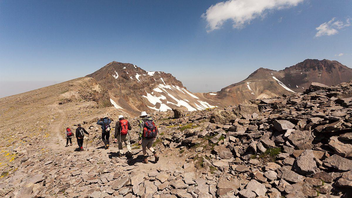
Mount Aragats is the highest point in Armenia, a huge extinct volcano about 60 km from Yerevan. Four summits ring a vast crater, and the road runs almost to the top: you can drive to Lake Kari at 3,200 m and reach the first summit in an easy half day. Above the alpine meadows, the views run from Ararat to the lava fields of Gyumri.
The mountain also holds some of the country's best walking. Wildflowers cover the slopes in early summer, the 11th-century Amberd fortress stands on a ridge at its foot, and in clear weather you can see Lake Sevan from the north summit.
От озера Кари до Южной вершины Арагаца (3879 м) с видом на вулканический кратер и Араратскую долину.
Длинный и непростой день до высоты 4090 м, высшей точки Армении.
Три высокогорных озера на склонах Арагаца, самое высокое на высоте около 3450 м.
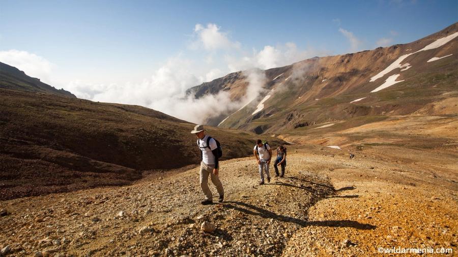
Lake Kari, whose name means Stone Lake, lies at about 3,200 m in a cirque of rocky slopes and is the usual starting point. A seasonal cafe stands beside it, and an asphalt road leads all the way up in summer. From here a clear path climbs about 5.5 km to the south summit at 3,888 m, gaining roughly 700 m. Most hikers need 2.5 to 3 hours up and about 2 hours down. No technical gear is needed.
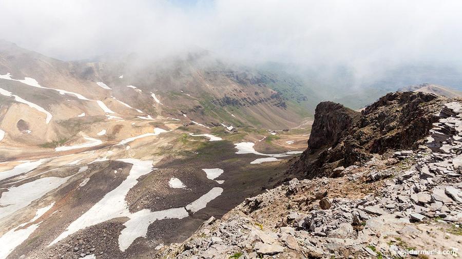
From the south summit a path follows the rim of the crater, about 3 km across, to the west summit at 3,995 m. The last section is a steeper climb on loose stones, so take your time and keep close together. Snow patches often last into July and make the crater floor glow white against dark rock.
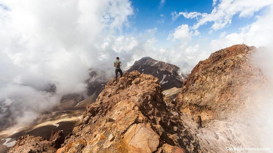
The north peak is the highest point in Armenia. It is usually climbed from the Gegharot waterfall side, about 6 km one way with a climb of roughly 1,090 m, or as part of a two-day crossing of the crater. On a clear day the summit looks over the whole of northern Armenia and out to Ararat and Lake Sevan.
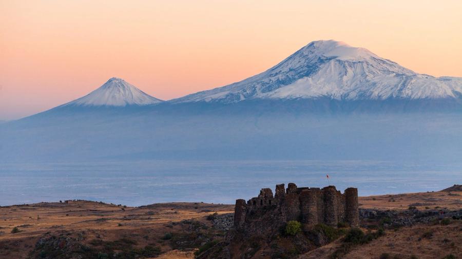
Amberd is a medieval fortress on a ridge at about 2,300 m, where two river gorges meet on the southern slope of Aragats. The walls and towers date mainly from the 10th and 11th centuries, when the Pahlavuni princes held it, and a small domed church built in 1026 stands in the shelter of the walls. The ridge and the gorges below make one of the most dramatic settings of any fortress in Armenia.
Aragats is a stratovolcano that last erupted about 800,000 years ago, leaving a wide caldera and four peaks. Its lower slopes have been used by farmers and shepherds for thousands of years, and the mountain appears in Armenian folklore as a sacred height. Ancient and medieval fortresses guarded the roads around it, from the Urartian period to the Pahlavuni princes, who built Amberd in the 10th and 11th centuries.
In the 20th century the mountain became a centre for science. Byurakan Observatory opened on its lower slopes in 1946, and a cosmic-ray research station still works high up at Nor Amberd, near 3,200 m.
| Когда | Что произошло |
|---|---|
| About 800,000 years ago | The last eruption of Aragats |
| 10th to 11th c. | The Pahlavuni princes build and expand Amberd fortress |
| 1026 | Amberd church of the Holy Mother of God is built |
| 13th c. | Saghmosavank and Hovhannavank are completed above the Kasakh gorge |
| 1946 | Byurakan Observatory is founded |
Aragats rises from dry steppe to alpine desert, and the plant life changes with every few hundred metres.
Snow still covers the high ground. The foothills and Amberd are green and quiet.
Good for Amberd and the lower slopes
The road to Lake Kari is open, the meadows are in bloom and the weather is usually clear in the morning.
Best for hiking and wildflowers
Cool, crisp air, golden grass and clear views. Light snow can arrive on the summits.
Best for photography and long views
Deep snow covers the mountain and the road to the lake closes. Only experienced mountaineers go up.
For snowy views from the foothills
Once you are at Lake Kari, everything is on foot. Taxis wait at the lake in summer for the return to Byurakan. For Amberd and the Kasakh monasteries, a car or a driver is the easiest way.
Most visitors stay in Yerevan and make Aragats a day trip. Byurakan and Ashtarak have guesthouses and small hotels, and in summer you can camp near Lake Kari if you bring your own gear.
A small cafe at Lake Kari serves tea, coffee and snacks in summer. In Byurakan and Ashtarak, look for roadside stalls with fresh lavash, cheese and honey, and for grilled meat at the village restaurants. Bring your own water for the walk.
Drive to Lake Kari in the morning, climb the south summit and return in time for lunch at the lake. Back in Yerevan by evening.
Start from the Gegharot side early and climb the north summit, then descend through the canyon.
Walk through the high meadows to the small alpine lakes with views of the crater rim.
The north summit is 4,090 m, the highest point in Armenia. The other three peaks are 3,995 m (west), 3,908 m (east) and 3,888 m (south).
Lake Kari, the usual start, is about 61 km from Yerevan, around 1.5 hours by car.
You can drive to Lake Kari at about 3,200 m in summer. The summits are reached on foot.
From late May to mid-October. Summer is the most reliable, with the road to the lake fully open.
Allow 2.5 to 3 hours up and about 2 hours down from Lake Kari.
The south summit is straightforward in good weather. A guide is useful for the north and east summits and for crossing the crater.
Сезонные советы, новые маршруты и идеи для вашей следующей поездки в Армению.
Спасибо. Мы скоро напишем.


