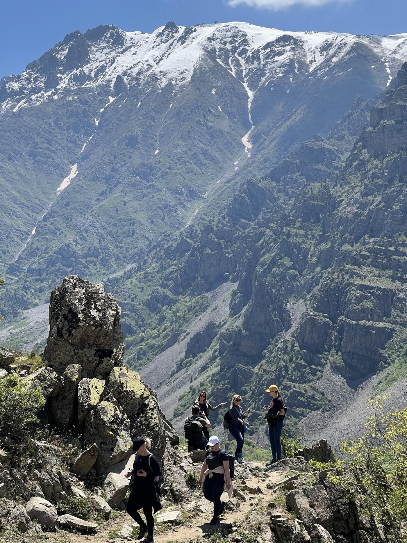
Short answer: the most popular hiking in Armenia is a handful of areas, each with its own season. For a first hike, take the Southern summit of Aragats in summer, a forest walk in Dilijan in spring or autumn, or the Haghpat to Sanahin walk in Lori. Geghama and the long Transcaucasian Trail are for confident hikers, usually with a driver or guide. The general hiking season runs from April to November, and high mountains are open from about late May to mid-October.
Which hike fits you?
- First hike, one day: Aragats Southern summit or a Dilijan forest walk.
- Easy and cultural: Haghpat to Sanahin in Lori, or short walks around Tatev.
- Wild and remote: Geghama and Azhdahak, with a 4x4 and a guide.
- Multi-day: the Dilijan section of the Transcaucasian Trail (4 to 5 days).
- Long-distance: the full Transcaucasian Trail through Armenia (about 820 km).
Mount Aragats: the high-mountain classic
Aragats has four summits around a crater: Northern (4,090 m, the highest in Armenia), Western (about 4,000 m), Eastern (about 3,900 m) and Southern (about 3,880 m). Most climbs start at Lake Kari at 3,200 m, which you can drive to in summer. The Southern summit is the easiest and most popular: about 5.5 km one way, 2.5 to 3 hours up. The Northern and Eastern summits are longer. The season runs from the end of May to mid-October, and there is no public transport to the mountain. See hiking Mount Aragats.
Dilijan National Park: forest and monasteries
More than 24,000 hectares of forest in the north-east, with easy to moderate day walks. The popular route is Parz Lake to Goshavank (roughly 8 to 10 km). Shorter walks lead to the Haghartsin waterfall and Gosh Lake. Autumn is the most picturesque season. For longer walking, the Transcaucasian Trail section runs about 80 km in 4 to 5 days. See hiking in Dilijan National Park.
Geghama Mountains and Azhdahak: wild and volcanic
Azhdahak (3,597 m) is the highest peak of the range, with a crater lake on top. This is the most remote popular area: open terrain, no marked trails, limited water and a 4x4 approach. The classic route is about 5.5 km one way with 600 m of ascent after a 14 km off-road drive. July and August are best. See the Geghama day trip.
Syunik and Tatev
Tatev Monastery sits above the Vorotan Gorge in the south. The Wings of Tatev ropeway spans about 5.7 km between Halidzor and the monastery and takes about 12 minutes, though it can run a reduced schedule or close in severe weather. Devil's Bridge, a natural bridge with pools, is in the same gorge. Walks around Tatev are best in spring (April to May) and autumn (September to October). Distances vary on different maps, so check a current map or ask locally. See Tatev.
Lori and the Debed Canyon
A high plateau cut by a gorge up to 350 m deep. The best-known sights are the UNESCO-listed monasteries of Haghpat and Sanahin, both built around the 10th century. The walk linking them is one of the best short hikes in the north and an excellent spring choice, and the forested trails of Lori and Tavush suit autumn. Ask locally for current distance and route conditions. See Haghpat and Sanahin.
The Transcaucasian Trail
A long-distance trail across the South Caucasus. In Armenia it runs about 820 km from Lake Arpi in the north to Meghri in the south, and a full hike takes from 25 days to over a month. The sections from north to south are Shirak (mostly flat and relatively easy), Lori, Tavush, Geghama (the most demanding and remote), Vayots Dzor and Syunik. Parts are unmarked or overgrown, so hikers need to be self-sufficient. Most visitors walk a single section. The Dilijan section is self-contained.
When to hike
- April to June and September to October: forest and valley walks.
- Late May to mid-October: high mountains, with the most settled weather from July to September.
- Summer below 2,000 m: too hot for most routes.
- Nights can reach freezing even in July and August at altitude.
The full breakdown is in best time to hike in Armenia.
How to choose a route
- Pick the month first. It decides which routes are open and comfortable.
- Match access to your plans. Aragats and Dilijan do not need off-road driving. Geghama usually needs a 4x4.
- Be honest about navigation. A day route with a clear path is not the same as a Transcaucasian Trail section.
- Plan for weather. Summer storms with lightning and hail are real. Start early and set a turnaround time.
- Check water. It is limited in Geghama, so carry what you need.
Rules and safety
Some areas are protected and rules change. Read hiking permits and protected areas and is hiking in Armenia safe, and pack with what to pack for a mountain day.
Plan it with us
Many routes can be hiked independently if you can navigate and have the right gear. Others, especially Geghama and multi-day sections, are easier with a local driver or guide. Browse our hiking and trekking tours or contact us with your dates, fitness and experience.