
Climb Azhdahak Volcano
A walk to the rim of an extinct volcano with a lake in its crater, the highest point of the Gegham mountains.
- 1 day
- Moderate · 12 km · 600 m ascent
- June to October
From125,000 AMDper group · 1 people
View tour
A volcanic range east of Yerevan with crater lakes, red cones and ancient rock carvings.
Written by Wild Armenia guides · Last verified 2026-11-03
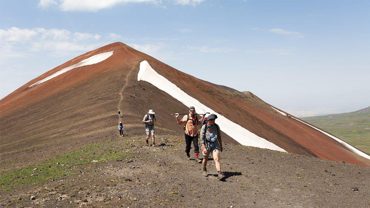
The Geghama Mountains are Armenia's wild volcanic highland, a high plateau dotted with red cones, crater lakes and meadows that stretches between Yerevan and Lake Sevan. Few roads cross it, so the walking is quiet, the sky is huge and shepherds still bring their flocks up each summer.
The range also holds some of the oldest traces of people in Armenia: carved dragon stones beside springs and rock carvings pecked into the boulders. Climb Azhdahak, camp beside Lake Akna or cross the plateau by jeep, and you will see a side of Armenia that most visitors never reach.
A walk to the rim of an extinct volcano with a lake in its crater, the highest point of the Gegham mountains.
A 4x4 track up to the extinct volcanoes of the Geghama range, with petroglyphs and dragon stones at the top.
An easy way to reach a high volcanic lake in the Geghama mountains: by 4x4, then on foot.
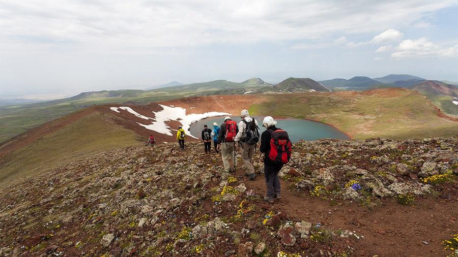
Azhdahak is the highest peak of the range at 3,597 m, an extinct volcano with a small lake sitting in its crater. Its name comes from the Armenian word for dragon, and legend ties it to the mythical dragon king Azhdahak. From the rim you can see Lake Akna, Lake Vishapalich and, on a clear day, the blue shape of Lake Sevan far to the east. The walk across meadows and red volcanic scree is a favourite day hike.
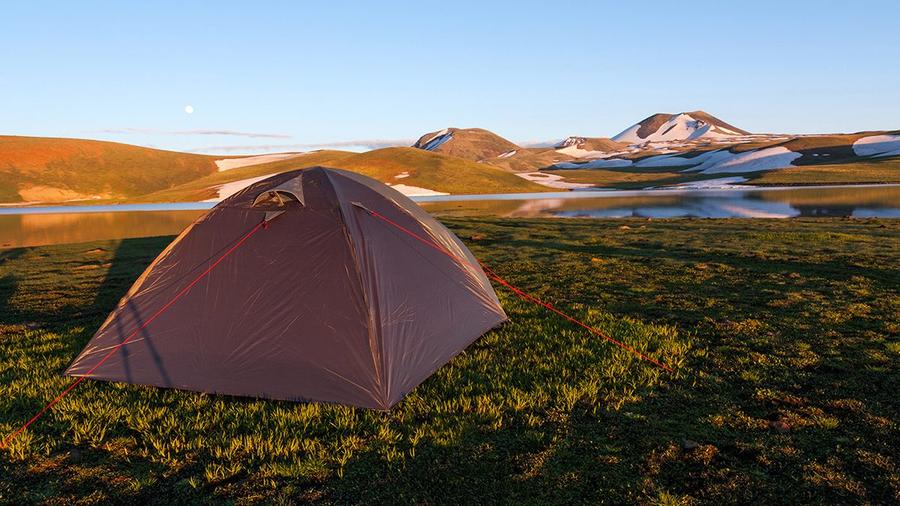
Lake Akna, whose name means Eye, lies in a hollow of the highland at about 3,000 m and is the best-known campsite of the range. The still water mirrors the peaks at sunrise, and the meadows around it fill with flowers in early summer. It is also the starting point for the Azhdahak climb, so many groups camp here for a night.
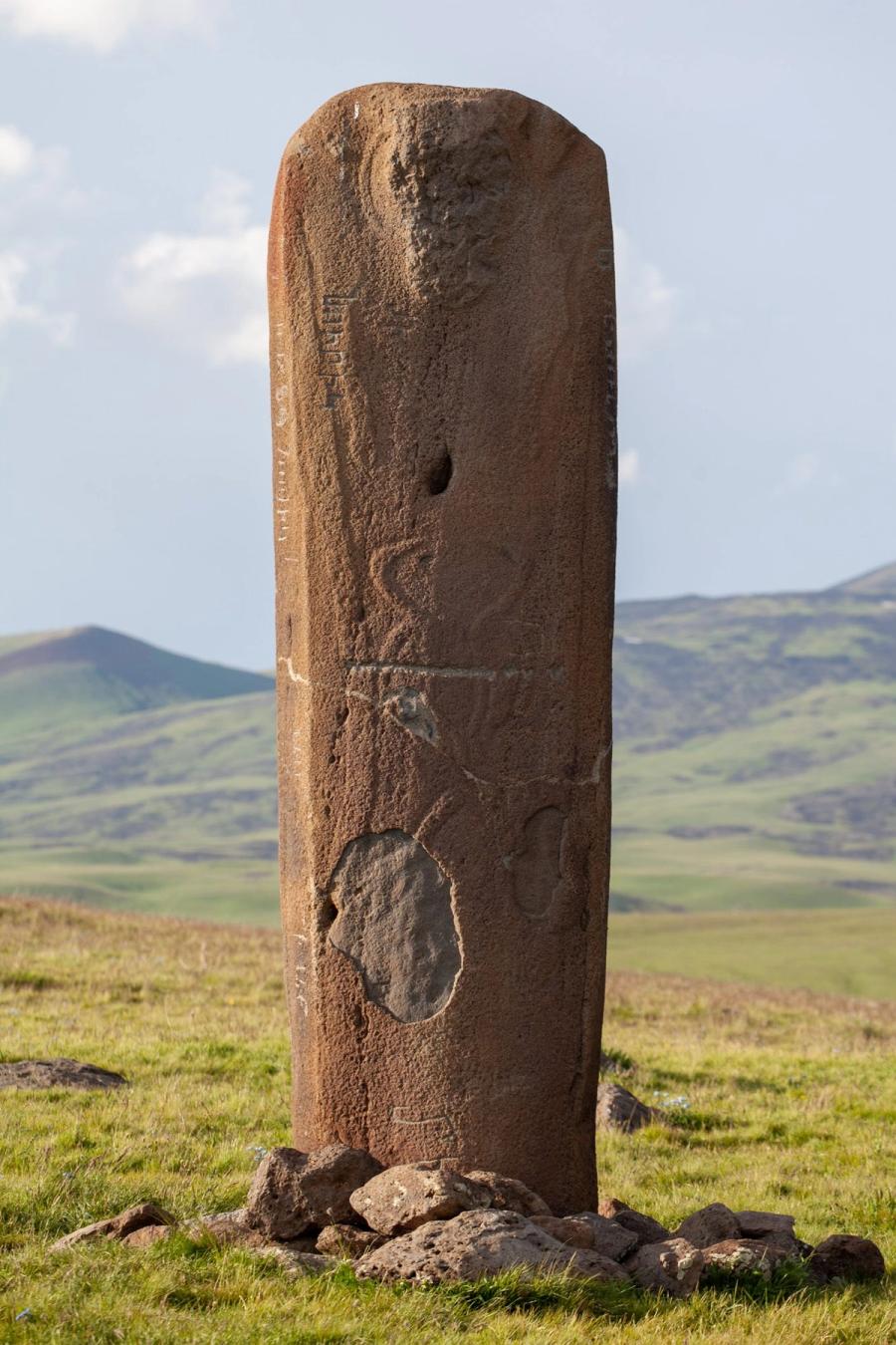
Vishaps, or dragon stones, are carved stone slabs raised beside springs and lakes thousands of years ago, probably to honour the gods of water. Some are shaped like fish, others like bulls or dragons. Several stand in the high meadows of the Geghama, and others are on display in Yerevan at the Matenadaran and in the Nor Nork district.
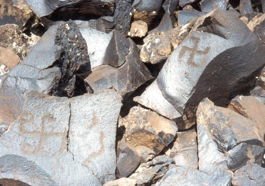
Rock carvings, or petroglyphs, are scattered over the dark volcanic boulders of the highland. Hunters, goats, deer and celestial symbols were pecked into the stone thousands of years ago, near the pastures and water sources the ancient herders used. Some sites are easy to miss, so a guide who knows the places makes all the difference.
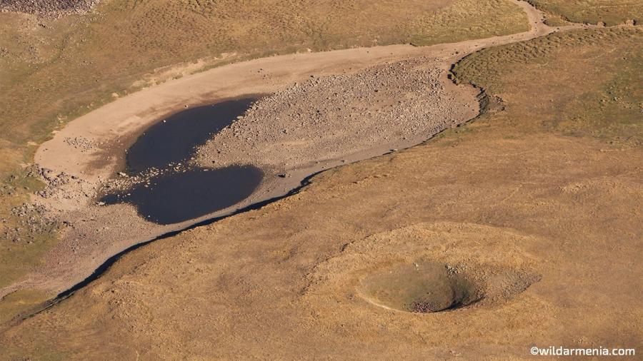
The plateau between the volcanoes is a world of small lakes, grassy basins and broad views. Cones such as Spitakasar, Geghasar and Gndasar rise gently above it, and each has its own colour of rock. Shepherd camps appear in summer, when flocks of sheep and horses graze the highland pastures.
Photos: Կարեն Թոխաթյան, CC BY-SA 4.0
People have lived and herded animals in the Geghama highland since the Bronze Age. The vishap stones and the rock carvings are among the oldest signs of this, and some of the carvings may be four thousand years old or more. The meadows were summer pastures for villages on both sides of the range, and shepherds still follow the old routes.
The range and the province of Gegharkunik both take their names from Gegham, a legendary patriarch of the Armenians, and its highest peak is named after the dragon king of Armenian legend. Its western slopes drop to the Hrazdan valley, its eastern slopes meet the lava fields on the shores of Lake Sevan, and its south-western part lies inside the Khosrov Forest State Reserve.
| When | What happened |
|---|---|
| Bronze Age | Vishap stones are carved and raised beside springs and lakes |
| Over thousands of years | Petroglyphs are pecked into the volcanic boulders |
| Summer, every year | Shepherds bring flocks to the highland pastures |
| 1958 | Khosrov Forest State Reserve, on the south-western slopes, is protected |
The Geghama range is a volcanic plateau with many extinct cones and several crater lakes. Its climate is cool and continental, with short summers and snow from late autumn.
Snow melts from the lower slopes and crocuses bloom. The high tracks are not yet open.
For early flowers on the lower slopes
Meadows are green, lakes are blue and the tracks are open. Mornings are clear.
Best for hiking, camping and jeep tours
Cool, crisp days with golden grass and sharp views over the range.
Best for photography
Snow covers the plateau. The high tracks close, and only experienced groups go up.
For snow views from the foothills
Inside the range, an off-road vehicle with an experienced driver is the only practical way between lakes and passes. Walkers can link Lake Akna, Azhdahak and the nearby lakes on foot over two or three days.
Most visitors sleep in Yerevan or on the shore of Lake Sevan and make the Geghama a day trip. For a longer stay, camp beside Lake Akna with a guide, or stay in a guesthouse in one of the villages at the foot of the range.
In the highland there are no cafes, so bring a packed lunch. Many tours include a picnic or a shepherd's lunch, with fresh bread, cheese, herbs and tea. At the foot of the range, the villages and the Sevan shore have restaurants serving grilled fish and khorovats.
Drive onto the plateau from Yerevan, stop at the vishap stones and Lake Akna, climb to a viewpoint and return by evening.
Climb the highest peak of the range, circle the crater lake and descend to Lake Akna.
Cross the range on foot from lake to lake, with camps in the meadows and views of Ararat and Sevan.
They lie between the Hrazdan valley near Yerevan and Lake Sevan, in the provinces of Gegharkunik and Kotayk.
Azhdahak is the highest peak of the range, at 3,597 m.
Vishaps are carved stone slabs, sometimes shaped like fish, that were raised beside springs and lakes thousands of years ago, probably to honour water.
Most of the range needs an off-road vehicle. Walkers can reach the lower meadows from the villages at its foot.
June to mid-October. July to September has the clearest weather.
Yes. Many groups camp there in summer, usually with a guide. Bring all your gear and take all your rubbish with you.
Get seasonal tips, new routes and ideas for your next trip to Armenia.
Thank you. We will be in touch soon.


